
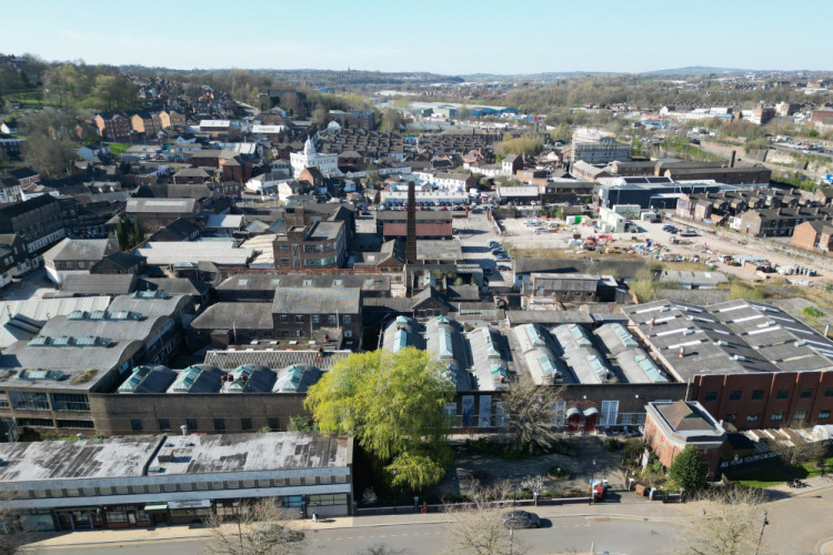
The Stoke-on-Trent sites where over 18,000 homes and businesses may be built
By Phil Corrigan - Local Democracy Reporter 20th Aug 2025
")


Members of the public will soon get to have their say on plans to build 18,528 homes on sites across Stoke-on-Trent.
Stoke-on-Trent's new local plan will guide all development in the city until 2040, setting out where new homes, businesses and infrastructure should be built.
While the document contains a raft of policies on issues such as transport, heritage and tourism, the most important parts of any local plan – and potentially the most controversial – are the site allocations.
Stoke-on-Trent City Council's draft local plan, which has now been approved for consultation, includes 60 specific sites earmarked for housing and another five allocated to mixed-use developments, which could deliver 8,029 homes between them.
There are also 11 'broad locations' – which sit almost entirely within the current Green Belt – which if developed together could provide a further 10,499 homes. Another 21 sites in the plan have been earmarked for employment use.
The council is under pressure to meet government-set housing targets – Stoke-on-Trent has been told to deliver 948 homes a year, or 18,960 in total over the plan period, which runs between 2020 and 2040.
Stoke-on-Trent's local plan also include a target of 84 hectares of employment land.
While all the 'broad locations' in the Green Belt are likely to be controversial, other sites within the draft plan could also face local opposition.
Site H58, at Packmoor, has been earmarked for 800 homes, and there has already been a campaign against the council's plans to develop the land, which it owns.
Major brownfield sites in the plan include Staffordshire Waste Recycling Centre, in Longport, which has been earmarked for 350 homes.
Council leaders say the local plan will ensure Stoke-on-Trent has the homes, jobs and infrastructure it will need over the coming years, supporting economic growth and sustainable development.
The local plan will go through two rounds of consultation before being submitted to the government in November 2026. The first six-week consultation will run from 8 September 8 to 20 October.
Sites included in the local plan will still require planning permission before they can be developed, but this will be a much easier process if they have been earmarked for development in the plan.
Here are all the site allocations in the draft local plan:
HOUSING
Displayed as Site - Site Address - Site Area (Hectares) - Potential Capacity (Dwellings)
H1 - Bell & Barker House, Ripon Road, Blurton - 0.56 - 49

H2 - Development Land at Bengry Road, Longton - 0.69 - 17
H3 - Land at Power Grove, Hollybush - 2.09 - 44
H4 - Land at Forrister Street, Meir Hay - 0.51 - 9
H5 - Booth Street, Phase II at Yeaman Street - 0.64 - 28
H6 - Site of Penkhull Farm, Garden Street, Penkhull - 0.63 - 25
H7 - Land off Bilton Street, Stoke - 0.59 - 28
H8 - Former Ashfields Cottages/Former Falcon Works, Sturgess Street - 0.62 - 8
H9 - Lucideon Ltd, Queens Road, Penkhull - 2.3 - 84

H10 - Spode Works, Elenora Street, Stoke - 4.07 - 113
H11 - Land at North Staffordshire Royal Infirmary, Princes Road/Queens Road, Hartshill - 8.75 - 200
H12 - Land at Central Outpatients/Central Pathology Laboratory, Thornburrow Drive, Hartshill - 2.36 - 80
H13 - Former Tuscan Works, Anchor Road, Longton and Wedgwood Hotelware Car Park, Forrister Street - 4.22 - 117
H14 - Ripon Road, Blurton - 1.02 - 78
H15 - Brookwood Drive, Weston Coyney - 5.07 - 124
H16 - Edensor Technology School, Edensor Road, Longton - 6.81 - 193
H17 - Parkhall Works, Parkhall Road - 1.29 - 60

H18 - Bird In Hand, 942 London Road - 0.1 - 8
H19 - Caverswall Lane, Meir - 13.89 - 169
H20 - Former Parkside Residential Home, Weston Coyney Road - 0.96 - 31
H21 - Potterycrafts Premises, Campbell Road, ST4 4ET - 1.1 - 80
H22 - St Peters High School, Queens Road, Penkhull - 1.98 - 20
H23 - Land at, Junction of Park Hall Road and Anchor Road, Adderley Green - 1.44 - 14
H24 - Trentham Fields, Wilson Road, Hanford - 68.3 - 471
H25 - Land at Vernon Road, ST4 2TP - 0.28 - 30
H26 - Berry Hill High School and Sports College, Bucknall, ST2 9LR - 7.88 - 200
H27 - School, Wellfield Road, Bentilee - 2.52 - 117
H28 - Stoke-on-Trent College, College Road - 1.04 - 108
H29 - Pyenest Street, Shelton - 2.15 - 141
H30 - North Shelton - 1.3 - 96
H31 - Land at Broad Street, Hanley - 0.74- 32
H32 - Bucknall New Road, Hanley - 4.31 - 337
H33 - Land to the south of Bucknall New Road, Hanley 1.38 - 110
H34 - Land off, Leek Road, Northwood, ST1 6AT - 0.29 - 27
H35 - Huntbach Street Car Park (Lower) and Hillcrest Street Car Park - 0.73 - 72
H36 - Cobridge Road, Etruria - 5.64 - 356
H37 - Portland House, Portland Street, Hanley, ST1 5NG - 0.43 - 40
H38 - Garth Street, Hanley - 0.1 - 42
H39 - Land off Redhills Road - 47.06 - 188
H40 - Scrapyard, Porthill Road, Longport - 10.05 - 350
H41 - Former Co-op Bakery Site, Newport Lane, Burslem - 1.98 - 151
H42 - Former Sneyd Surgery, Sneyd Street, Sneyd Green - 0.27 - 5
H43 - Land between Duncalf Street and Dain Street, Burslem - 1.27 - 70
H44 - Land at, Bournes Bank and Woodbank Street, Burslem - 2.24 - 54
H45 - Royal Doulton, Nile Street, Burslem - 4.67 - 99
H47 - Wade Factory, Hall Street, Burslem - 1.43 - 60
H48 - Wedgewood Place, Burslem - 0.59 - 81
H49 - Davenport Street, Trubshaw Cross - 0.91 - 50
H50 - Land between Huntilee Road and Scotia Road, Scotia Road, Tunstall - 9.2 - 320
H51 - Ford Green House, Ford Green Road, Smallthorne - 0.27 - 9
H52 - Royal Doulton, Leek New Road, Baddeley Green - 6.72 - 138
H53 - Land at, Furlong Road, Tunstall - 0.91 - 30
H55 - Heathfield Special School, Chell Heath Road, Chell Heath - 1.54 - 113
H56 - Fegg Hayes Social Club, 70 Oxford Road, ST6 6QP - 0.62 - 14
H57 - Crownford Works, Newcastle Street/Packhorse Lane, Burslem- 0.53 - 68
H58 - Packmoor - 82.03 - 800
H59 - Canal Lane, Tunstall, ST6 4PQ - 5.37 - 100
H60 - Sports Field, Biddulph Road, Fegg Hayes - 4.34 - 2
H61 - Stoke Car Park and Depot, Booth Street, Stoke - 0.82 - 77
H62 - Penkhull Education Centre, Princes Road, Penkhull, ST4 7JS - 0.5 - 20
MIXED USE
Displayed as: Site - Site Address -Site Area (Hectares) - Potential Capacity (Dwellings)- Potential Capacity (m2)
M1 - Goods Yard - 0.6 - 174 - 3744
M2 - Phoenix Works, 500 King Street, Longton - 0.14 - 25 - 120
M3 - Land off, Lordship Lane, Fenton - 9.4 - 715 - 1892
M4 - Central Business District (Smithfield) - 1.86 - 266 - 44592
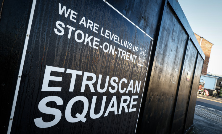
M5 - Etruscan Square, Hanley - 2.72 - 292- 12445
EMPLOYMENT
Displayed as: Site - Site Address - Site Area (Hectares) - Potential Capacity (m2)
E1 - Meir Depot. Uttoxeter Road, Meir, ST3 6AA - 1.77 - 6680
E2 - Riverside Park off Campbell Road - 0.85 - 3400
E3 - Land off Mossfield Road, Adderley Green - 0.86 - 3440
E4 - Marl Hole, City Road, Fenton - 15.11 - 59720
E5 - Land to east of Dewsbury Road, Fenton - 11.48 - 45000
E6 - Land East of, Brocksford Street, Fenton - 0.98 - 2040
E7 - Staffordshire House/Fenton 25 - 9.42 - 75000
E8 - Botteslow Street, Hanley - 1.2 - 4800
E9 - Land south of Clough Street, Hanley - 2.86 - 11000
E10 - Etruria Valley Phase 2A, Forge Lane, Etruria (Plot 7 Etruria Valley) - 1.3 - 4900
E11 - Cobridge Road (West), Hanley - 1.79 - 1309.5
E12 - Former Greenhouse 2000 site, Festival Way, Etruria - 1.7 - 6800
E13 - Cliffe Vale/Caradon Twyfords Excelsior Wks/Former Slimma - 17.7 - 70800
E14 - Land adj Newstead Industrial Estate, Alderflat Drive, Newstead - 4.91 - 19435
E15 - Land east of, Scott Lidgett Road, Middleport - 0.37 - 1480
E16 - Former Ravensdale Sportsfield, Land off Chemical Lane, Tunstall - 17.17 - 35046
E17 - Land off Hollywall Lane and Chatterley Road, Sandyford - 9.03 - 15850
E18 - Severn Trent Depot, Federation Road, Burslem - 2.39 - 9000
E19 - Canal Lane, Brownhills, Tunstall - 8.68 - 17415
E20 - Newcastle Street, Middleport - 1.42 - 6172
E21 - Chatterley Valley (Area 1) - 3.12 - 12500
BROAD LOCATIONS
Displayed as: Site - Site Address - Site Area (Hectares) - Potential Capacity (Dwellings)
BL1 - Lightwood - 115.89 - 3000
BL2 - Trentham - 59.93 - 500 - potential capacity m2 25000
BL3 - Caverswall Lane - 13.69 - 305
BL4 - Norwich Road - 18.65 - 73
BL5 - Eaves Lane - 38.21 - 1139
BL6 - Woodhead Road - 15.63 - 425
BL7 - Norton Green South - 87 - 2278
BL8 - Hollywall Lane - 29.42 - 400
BL9 - Chatterley Whitfield - 121.14 - 1500
BL10 - Norton Green North - 43.57 - 819
BL11 - Baddeley Edge - 46.65 - 60
CHECK OUT OUR FREE NEWSLETTER!
5 TOP STORIES EVERY FRIDAY!
Click here to sign up: stoke newsletter

Share:

")
 and Burslem Park have been awarded Green Flag status (image via Nub News)")